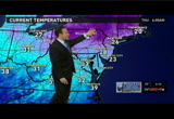
we've got energy to the north, energy to the south. they're going to come together off shore. this is really going to develop just east and northeast of us. for us the clouds thicken up today. tonight we're going to watch as the moisture moves in, especially after the midnight hour. far west and north, some sleet, snow, freezing rain mixing in. could be a few icy issues well north and west of d.c. tomorrow morning. here comes the bulk of the rain midday into the afternoon, especially east of town. there goes low pressure scooting off to the east with snows wrapping around into friday night and saturday early. so some snow showers here and heavy, heavy snows up across areas of new england. just want to show you one computer model here. the snow projection for new england. all these areas in orange are two feet or more. i've seen even higher totals than this so locally 3 feet possible. don't think it will make it into northern new jersey but going to be one heck of a snowstorm up there. around here temperatures only in the low 40s with the clouds around. a peek of sun early. ton
 Live Music Archive
 Librivox Free Audio
 Metropolitan Museum
 Cleveland Museum of Art
 Internet Arcade
 Console Living Room
 Books to Borrow
 Open Library
 TV News
 Understanding 9/11